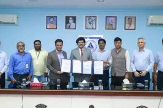
The Maharashtra government has launched the Maharashtra Land Bank, a unified digital platform designed to bring information on government-owned land under different state departments onto a single dashboard. Chief Minister Devendra Fadnavis said the system will make government land information more accessible, help speed up infrastructure development and ensure the availability of land required for compensatory afforestation.
The digital system was launched following the state Cabinet meeting held on Tuesday. Additional Chief Secretary (Revenue) Vikas Kharge, Additional Chief Secretary (Forest) Milind Mhaiskar and Settlement Commissioner Shailesh Naval made a detailed presentation on the functioning of the dashboard.
The Maharashtra Land Bank is intended to simplify the identification, verification and allocation of government land by bringing records maintained across different departments and administrative levels onto one common digital platform. According to Fadnavis, the system will support better utilisation of land, faster department-specific mapping, reduced delays in decision-making and greater administrative transparency. It will also allow performance monitoring through data aggregated at the department, district, taluka and village levels.
Single repository for government land records
The government said fragmented land records have often made it difficult to obtain timely information about the availability, status, area and existing use of government land, as well as violations of allocation conditions.
The new platform integrates land records with physical site inspections, GIS-based analysis and MIS reporting to create a single and updated repository. Its features include record verification, on-site inspection and validation, an integrated data repository, taluka-level access, GIS analytics and an online land requisition process.
Officials will be able to carry out preliminary verification of survey numbers, total land area and land classifications using e-Pherphat, or electronic mutation records, along with existing documentation. Field inspections will further help verify the physical status of land, identify unallocated parcels and detect violations of allocation conditions. Information collected from different sources will subsequently be consolidated in a central digital repository.
Tehsildars to update land allocation details online
Under the system, Tehsildars will receive dedicated portal access to update the allocation status of government land and Occupant Class-II (Bhogwatdar Varg-2) land. They will also be able to record violations of allocation conditions directly through the platform.
The location-based mapping system will support spatial analysis of available land parcels and pending allocation cases. Government departments will be able to submit land requisitions and applications online and take them through scrutiny, verification and approval through an end-to-end digital workflow.
The portal will also record site inspections in real time, including GPS coordinates, timestamps and dates. The government expects the system to help departments identify suitable land more quickly, strengthen monitoring and reduce delays in decisions related to government land.